Satun Province in Southern Thailand
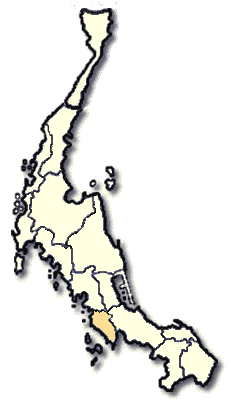
Satun is a small province, one of the Southern Four Provinces, where about 80 percent of the Thai Islamic population live. It is difficult to find for a pork dish. It is famous for its Ko Tarutao, the territory of pirates and beautiful Ko Adang-Rawi. Satun is located some 973 kms. from Bangkok on the west coast of the Malayan Peninsula facing the Indian Ocean, occuping an area of 2,478 square kilometers. It borders on Trang, Phattalung and Songkhla to the north, Perlis State of Malaysia to the south, Perlis State and Songkhla to the east and the Indian Ocean to the West. The area is of mountainous, having a basin in the coastal area, and there are more than 60 off-shore islands. It is administratively divided into 6 Amphoes, i.e., Muang, Khuan Ka Long, Langu, Thung Wa, Khuan Don and Tha Phae.
What to see and what to do in Satun?
Tarutao National Park is an archipelago in Tambon Ko Sarai, Amphoe Muang. It's the first marine national park of Thailand. The park consists of 51 islands covering the area of 1,490 square kilometers and could be divided into two main parts, i.e., Tarutao and Mu Ko Adang-Rawi.
Ko Tarutao is the biggest island in the park. It used to be a prison for long term punishment and political prisoners. There are many attractive beaches: Ao Phante Malaka, , where the office of the park is located; Ao Mo Lae and Ao Son. Furthermore, there are waterfalls, caves, view points, beautiful coral reefs which accommodate various kinds of sea faun. There are historical sites of prison ruins at Ao Talo Udang and Ao Talo Wao.
Mu Ko Adang-Rawi islands are 40 kms. west of Ko Tarutao and are famous as a sea turtle egg laying area. Also, the residences of the Chao Le(the sea gypsies) are in this areas. Several neighbouring islands, such as, Ko Li Pe (where beautiful undersea nature can be seen), Chao Le community with a school; Ko Hin Ngam (where very beautiful unusual looking rocks are seen), Ko Khai ( a small island with a strange looking natural stone arch where sea turtles laying eggs)and th beautiful beaches and coral reefs at Ko adang-Ko Rawi, etc.

Koh Lipeh, Andaman Sea - www.subvision.net
To get to the park take a boat from Pak Bara pier, Amphoe Langu. The best time to visit to the park is during November to May.
Mu Ko Phetra National Park is in the areas of Satun and Trang. It is comprised of many islands, such as, Ko Phetra (a junk-shape island), Ko Khao Yai, Ko Lalobaentae, Ko Lidi, Ko Bulon,Ko Laoliang and Ko Perama. The national park area covers the coastline from Amphoe Langu to Amphoe Thung Wa. The office of the national park is located on highway no.416, 3 kms. before Pak Bara Pier or 7 km. from Amphoe Langu and 56 kms. from Satun. Boat trips to the islands around the national park area are available from Pak Bara pier.
Thale Ban National Park is located in the areas of Amphoe Muang and Amphoe Khuan Don. It is a lagoon surrounded by mountains. There are a lot of fishes in the lagoon where the surroundings are beautiful. Furthermore, there are: Rani Waterfall (a small waterfall near the office of the park), Yaroi Waterfall (a medium size waterfall 7 kms. from the office of the park), Ton Pliu Waterfall (the most beautiful waterfall of the park, situated some 6 kms. from Nam Tok Yaroi), Tham Lot Puyu ( an aquatic grotto can be reached by boat from Tammalang peir which is 9 kms. from town)and the Thai-Malaysian Border ( only 2 kms. from the office of the park).
To get to the National Park take highway no.406 from town for 19 kms. and turn right to highway No.4184 for another 20 kms. Accommodations are available by calling National Park Division, Royal Forestry Department, Tel. 579-0529, 579-4842.
Panan Waterfall is located in the areas of Tambon Thung Nui, Amphoe Khuan Ka Long. It has 10 levels surrounded by a pleasant forested area suitable for sightseeing.