Roi Et Province in Northeastern Thailand
Once a prosperous, extensive community but ravaged by floods, Roi Et has made a come-back. It is a town of great promise, with its huge Thung Kula Rong-Hai (flatland) being developed into a fertile and productive land. Roi Et is 512 kilometers from Bangkok.
What to see and what to do in Roi Et?
Bung Phlan Chai
A lake in the town center which has been deepened to make a beautiful spot for the town people. It is also where the Roi Et Town pillar is located.
Wat Klang Ming Muang is also located in the provincial town. Its monastic hall is more than 200 years old and houses mural paintings depicting the Life of the Lord Buddha. In the reign of King Rama V, the Swearing-In Ceremony was held at this temple.
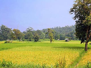
Rice fiels in Roi Et province Courtesy : www.stickmanbangkok.com
Wat Buraphaphiram is situated in the provincial town. The country's highest standing Buddha image, reaching 67.85 meters in height is enshrined in this temple.
Ku Ka Sing, a large Khmer architecture dating between 1017-1087 A.D., is located in Amphoe Kaset Wisai. Travel 60 kilometers along Roi Et-Surin Road until arriving Ku Phra Kona and turn right into the road leading to Ku Ka Sing, 18 kilometers away. The remains consist of 3 prongs located on the same sand stone basement and rectangular buildings called Bannali situated at two sides in front. All buildings are surrounded by the wall.
Pha Nam Yoi Forest Park is located in the northeast of Amphoe Nong Phok, 65 kilometers from Roi Et. Pha Nam Yoi is a large stone cliff having year round running water and small springs. On the hill is a monastery with a large multipurpose building and big pagoda of 101 meters in height.