
Phetchabun Province in Northern Thailand
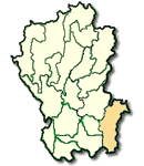
Phetchabun is the province situated almost at the middle of Thailand, 346 kms. from Bangkok and occupies an overall area of 12,668 square kilometers. It is administratively divided into 11 Amphoes : Muang, Lom Sak, Chon Daen, Lom Kao, Wichian Buri, Nong Phai, Si Thep, Bung Sam Phan, Wang Pong, Nam Nao and Khao Kho
What to see and what to do in Phetchabun?
Wat Mahathat monastery has a 3-meter-high, Sukhothai style, Phum Khao Binth design Pagoda. In March 1967, during renovation by the Department of Fine Arts, several Buddha images of various periods were discovered.
B.N. Farm, very famous for the cultivation of cold weather vegetables, is located on Lom Sak-Phitsanulok Road at km. 100 where a 3 km. access road branches off to the farm. Visitors can sightsee and buy the farm produce.
Wat Traiphum, located on Phetcharat Rd., houses a Buddha image named "Phra Buddha Maha Thammaracha", which has existed as long as Phetchabun. It is cast in the ornamental Lopburi style. This image was found by the city inhabitants in the Pa Sak River in front of Wat Traiphum and was invited to be housed Traiphum Monastery. Later on, it disappeared and was found again at the bottom of Mae Nam Pa Kak in the very same location. Hence,at the annual Sart Festival of Petchabun thePhra Buddha Maha Thammaracha is paraded around the city until the procession arrives at the spot where the Buddha image was found. Then, the Governor of Phetchabun carries it into the water (diving four directions). This is belived to yield prefection for the city inhabitants.
Nam Nao National Park is located at km.49-50 from Lom Sak to Chum Phae on Highway No.12 linking the northern region. Nam Nao National Park is a very attractive place for sightseeing with resources, such as, waterfalls, caves and various species of plants. Because of its cold weather, the area was originally called "the cold weather forest". Accommodation reservation can be made at the National Park Division, Forest Department.
Si Thep Historical Park
Si Thep city is situated 107 kms. from Petchabun city on Phu Khae-lom Sak Road. Approximately 1,000 years old, it was the city during the prosperous ancient Khmer period having a lot of archaeological ruins and old objects on display. The park is open daily from 8:30-16:30 hrs. Admission fee is 20 Baht.
Phu Hin Rong Kla National Park is similar to Khao Kho Park but with different details in the surrounding scenery. The area is a large stone platform called "Lan Hin Taek" and "Lan Hin Pum", having long, deep cracks in some places and occupies a vast area dotted with small shrubs. Points of interest are ruins from old battles, the Office of State Power and CT Hospital. Phu Hin Rong Kla is accessible via Petchabun-Lom Sak Road to Highway No.12 to Ban yaeng and proceed on to Amphoe Nakhon Thai where an access road branches off to the park.Accommodation reservations can be made at the National park Division, Forestry Department, Bang Khen, Bangkok 10900.
Khao Kho mountain used to be an important battle field. Within this range are outstanding spots of beautiful scenery that should be visited. They include Khao Kho Palace, Khao Kho Monument, viewing point at Itthi Base, Weapon Museum and Sidit Waterfall. It is 26 kms. beyond B.N. Farm on the same route.