
Phayao Province in Northern Thailand
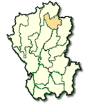
Phayao has an overall area of 6,355 square kilometers and is administratively devided into 7 Amphoes (Districts) and 2 King Amphoes (Subdistrict): Amphoe Muang, Chun, Chiang Kham, Chiang Muan, Dok Kham Tai, Pong, Mae Chai, King Amphoe Phu Kam Yao and King Amphoe Phu Sang. Phayao is located 690 kilometers from Bangkok.
What to see and what to do in Phayao?
Wat Si Umong Kham has a pagoda of the Chiang Saen Period in perfect conditions. This monastery also houses the Buddha image "Luang Po Ngam Muang Ruang Rit" or the so-called "Phra Chao Lan Tu". It is regarded as the most beautiful Buddha image of Lanna Thai and a unique artistic symbol of Phukamyao, the ancient Phayao Kingdom.
Wat Si Khom Kham is located in Amphoe Muang on the bank of Phayao Lake (commonly called "Wat Phra Chao Ton Luang") and houses a principal Bhudda image having a lap width of 14 meters, height of 17 meters. The annual fair takes place every May. Located within the monastery compound is "Ho Thai Nithat", a building with antiques, literary items, local intellectual displays and Phayao's life style scenes are shown.
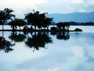
Phayao lake
Wat Analayo is on Doi Busarakham, 20 kms. from town to the north. It is a large temple built by a Thai monk, who was known as "Phra Kru Phaiboon". Within its wide compound, resides a big, beautiful Buddhist image of the Sukhothai style, as well as, many other interesting structures.
Doi Luang National Park covers areas in Chiang Rai, Lampang and Phayao. The main attraction in Phayao's area is " Champa Thong Waterfall". This beautiful waterfall is situated at Km. 7 on Phayao-Chiang Rai Highway, about 18 kms. from town.
Wiang Lo Ancient Town or "Muang Phra Lo" is located around 17 kilometers away from Amphoe Chun along highway no. 1021. At Ban Huai Ngiu, there is a branch to Ban Nam Chun, which is about 12 kilometers along a dusty road. From the remainings of the old city walls and a lot of deserted temples, the site was assumed to be a city in the reign of Pho Khun Ngam Muang (King Ngam Muang). Here, an old monastery "Wat Si Ping Muang" is located. As this area is adjacent to the point where the Chun River runs to join the Ing River. It is locally called "Sop Ing" (a meeting point).
Nam Pin Waterfall is located at Mu 9, Tambon Fai Kwang, Amphoe Chiang Kham. It cascades from a 10 meter high cliff and is 107 kms. from the township area by road.