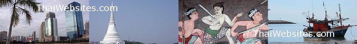
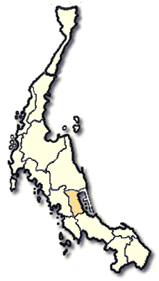
Phattalung Province in Southern Thailand
 Phatthalung, well known in the South as the town of the hollow hill, is located on Trang-Songkhla Highway some 840 kms. from Bangkok and 56 kms. fear Trang. Entering the town of Phatthalung, one can see the hollow hill located in the heart of the city as if it were the symbol of Phatthalung.
 Phatthalung, a beautiful town with the lake originating from Songkhla, is famous for two art forms, Manora and Shadows Play. It occupies and area of 3,424.5 square kilometers and administratively divided into 8 Amphoes and 2 King Amphoes. They are: Amphoe Muang, Khao Chaison, Khuan Khanun, Pak Phayun, Kong Ra, Tamot, Si Banphot, Pa Bon, King Amphoe Pa Phayom and King Amphoe Bangkaeo. The area is mountainous and forested with a high plateau in the west sloping down towards the east through Songkhla Lake. It borders on Nakhon Si Thammarat and Songkhla to the north, Songkhla to the south, Songkhla Lake to the east, Trang and Satun to the west.
What to see and what to do in Phattalung?
Tham Khuha Sawan
Before arriving at downtown Phatthalung, one can see a hill, the top of which is divided in half. The cave is located in the left half. In it, Buddha images are enshrined along the wall, the same as in Suwan Khuha Cave of Phang-nga. However, King Rama V and VII have paid royal visits to this cave.
Khao Ok Thalu
The hollow hill, about 250 meters high, is situated to the east of the Railway Station. One can climb to the mountain top where there is a hole to look through. It has become a symbol of Phatthalung.
Hat Sansuk Lampam is a beach on the shore of Songkhla Lake, located 8 kms. from the town. The beach is lined with pleasant pine trees. Looking out from the shore, beautiful islands are seen here and there.
Khao Khram Waterfall is located in Amphoe Muang, 30 kms. from the township area. The waterfall cascades from the high cliffs, level by level, surrounded by the evergreen forest and has a reservoir for swimming at the lowest level.
Tham Malai is located in the same range of Khao Ok Thalu and has beautiful milky white stalagmite and stalactite formation. There are ponds with clear and clean water inside the cave.
Khao Chaison Hot-Cold Water Ponds is one kilometer from the Khao Chaison District Office. The hot water pond is located at the foot of Khao Chaison Hill having hot water running continuouly. A cold water pond, having a lot of small fishes, is located nearby.
Wat Khian Bang Kaeo
These Buddha relics are enshrined in an old chedi located in the old town of Bang Kaeo. It is the oldest statutory place in Phatthalung and was constructed in Ayutthaya period. It is on highway no.5018 not very far from Khao Chaison District office.
Thale Noi Waterfowl Park park has a very big lagoon with more than a hundred species of waterfowl. It is located in Tambon Thale Noi, Amphoe Khuan Khanun, 15 kms. from the District Office and links to Songkhla Lake.
Khao Pu-Khao Ya National Park
To get there, take highway No.41, Phatthalung - Khuan Khanun and turn left on highway no 4164 to Amphoe Si Banphot where the national park is located. Khao Pu - Khao Ya National Park covers the areas of Nakhon Si Thammarat, Trang and Phatthalung. The main attractions in the park are: Tham Mat Cha Pla Won (a cave near the park's office with beautiful stalactites and stalagmites),t a pool of 400 square meters with fish swimming in it, Riang Thong (a waterfall which is located some 3 kms. from the park),viewing points and walking trails.
In addition, Phatthalung also has several beautiful waterfalls along highway no.6122. They include Mom Chui Waterfall in Amphoe Tamot, Ban Ton Waterfall in Amphoe Muang and Rai Nua Waterfall & Phraiwan Waterfall in Amphoe Kong Ra.